Ireland Part 2
Day 3- Ring of Dingle and Killarney
After a late night in the pubs in Galway, we packed up and began our trip along the Ring of Dingle. The Dingle Peninsula is a scenic drive in Ireland's southwest known for its dramatic cliffs, sandy beaches, and ancient sites. The Slea Head Drive is a circular route that begins and ends in Dingle. The drive takes you through villages, famous Hollywood film locations, and views of the world-renowned Blasket Islands and distant views of the Skellig Islands. The Dingle Peninsula is Ireland's westernmost Peninsula that stretches into the Atlantic Ocean for about 30 miles. Travelers are strongly advised to travel clockwise to avoid meeting the large tour buses. Parts of the Slea Head Cliff Road are very narrow and single-lane.
Our first stop was the Fahan Beehive Huts. There is a small fee ($3) to see the 19 underground structures and 18 beehive huts dating from 1000 years ago. Our next stops included Inch Beach, a long sandy beach with beautiful views and gorgeous ice blue water, Prehistoric ruins, a roadside ivory structure of the crucifixion, and my favorite, "Kruger 's Bar," Ireland's most westerly pub. The bartender claimed to make the best mojito. I challenged that assertion as I was positive the Puerto Ricans claimed that fame. Well, I lost. It was amazing!!! National Geographic voted The Dingle "the most beautiful place on earth.
We spent 2 nights in Killarney at the cute bed and breakfast Abbey Lodge. Killarney is a small town in County Cork, Ireland. It is known for its lakes and mountains and is home to Killarney National Park (est 1932). I would love to take a horse-drawn carriage through the Park for the next trip. The name Killarney means "church of shoes" in Irish. Ross Castle, Muckross House, and St. Marys Cathedral are also on my list for my next visit. We did visit several great restaurants and found live music everywhere.
Day 4- Ring of Kerry Peninsula
The Ring of Kerry route is 111 miles long and takes you through the towns/villages of Kenmare, Sneem, Caherdaniel, Waterville, Cahirciveen, Kells, Glenbeigh, Killorglin, and Beaufort. If you drove the Ring without stopping, it would take appr. 2.5 hours, but to explore, you need at least 7 hours. Given our limited schedule, our stops were limited. The Staigue Stone Fort is worth a visit. Thought to have been constructed between 300-400 AD, this fort was built as a defensive structure likely for a local king. It was partly restored, and you can walk inside. There are some glorious views of the countryside too. We also stopped at Derrynane Beach, one of Kerry's best beaches. The beach is reasonably sheltered and has a natural harbor. Remove your shoes and take a walk in the cool, clear water. Don't miss Derrynane Abbey (believed to date to the 16th century) as you walk along the sand. Stop for lunch at The Blind Piper located in Caherdaniel.
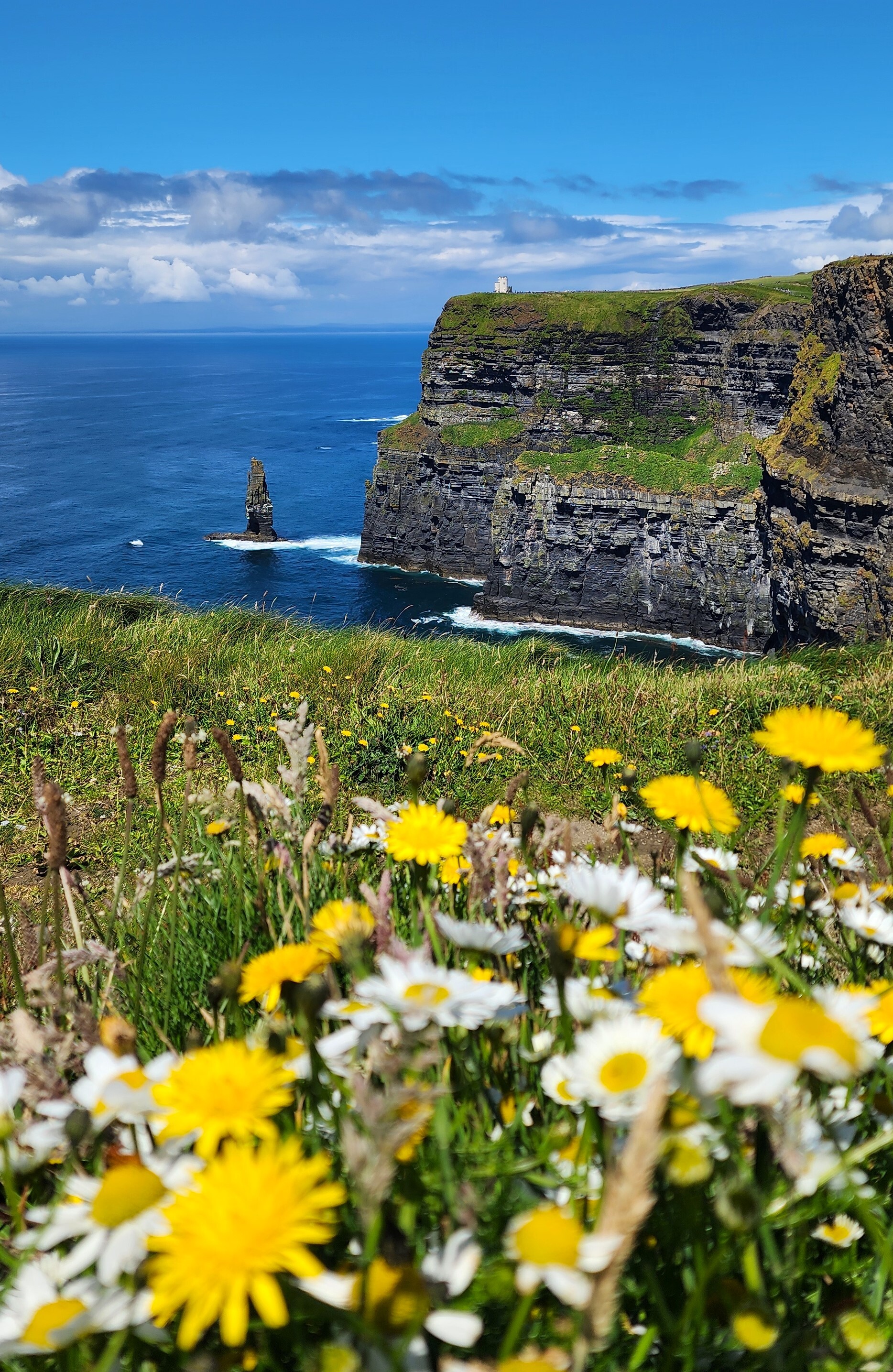
A must-stop is the Kerry Cliffs. Kerry's most spectacular sea cliffs are the nearest point on the mainland to view the Skellig Islands. The two islands are named Skellig Michael and Little Skellig. These cliffs stand over 1000 feet above the Atlantic, and the entire site was designated a UNESCO World Heritage site in 1996.
The drive along the Ring of Derry is an iconic historical region in Ireland's lush green hills filled with diverse wildlife, including sheep, deer, birds, foxes, slugs, and along the coast, whales, turtles, dolphins, etc. I would include Killarney National Park, Ladies View, Ross Castle, Muckross Abbey, Torc Waterfall, and Moll's Gap for my next trip.
To be continued!